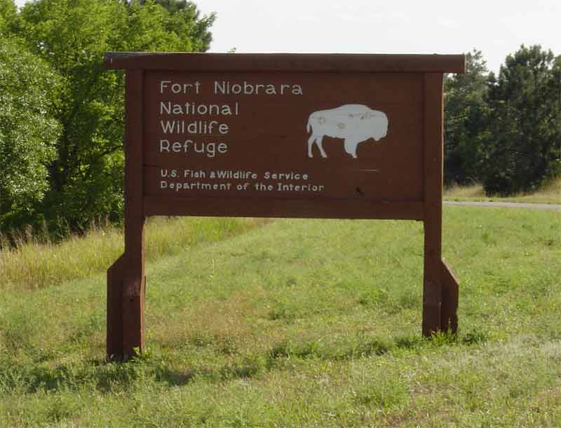
On a recent 1,200 mile trip to the Nebraska Panhandle and back, I wasn't looking forward to the drive across I-80, so I headed north to Sioux City, Iowa, then west on US 20. It was a much more scenic and less stressfull drive than the Interstate. About 230 miles west of South Sioux City, I took a break at the Fort Niobrara National Wildlife Refuge, near Valentine.
 Just past the Visitor's Center, on the way to Fort Falls, I drove through a black-tailed prairie dog town.
 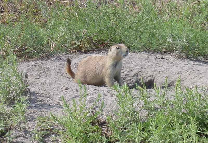 At the Fort Falls trailhead, is the Niobrara River Overlook, where you can view the Ponderosa pines that northern Nebraska is known for.
 Fort Falls lies at the bottom of a short trail down a ravine, then continues to the river.
 Up in the northwest corner of Nebraska, only 18 miles from South Dakota and 50 miles from Wyoming, is Chadron. The town lies along the eastern edge of the fur trade area that trappers and mountain men explorered on the 1830s and 1840s. The Museum of the Fur Trade is 3 miles east of town and well worth the $5 admission. For only $15, you can be a member, get free admission to the museum, receive the Museum of the Fur Trade Quarterly and get 10% off museum shop items. The shop includes many, very nice, hand-crafted items and every conceivable book on the fur trade era, so that 10% discount will come in handy.
 The Bordeaux Trading Post was built by the American Fur Company in 1837 to buy buffalo robes from the Sioux Indians.
 One of the items on display is this buckskin frock coat, with fine hand-stitched embroidered decoration.
 Chadron has a commercial airport too, but... is that... a combine parked at the hangar?
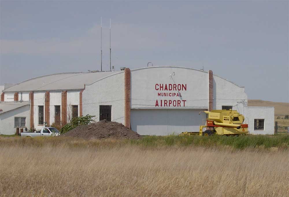 This shelf cloud moved into the area close to sunset and brought a lightening storm with it, but only a few drops of rain.
Chadron has been in the news the past few weeks due to several range fires, probably caused by lightening strikes, which blackened the beautiful Pine Ridge and threatened many homes, as well as the town itself. Just south of the Chadron State College campus is "C Hill," which now stands for "charred."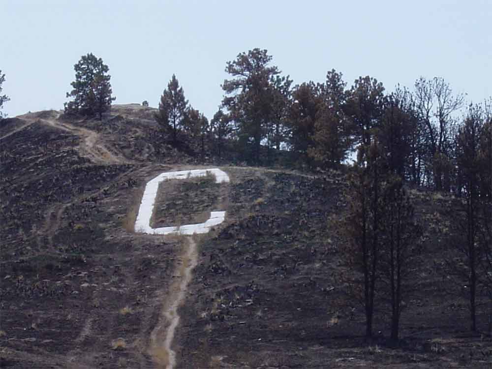 South of Chadron on Highway 385, are other remnants of the fire's path.
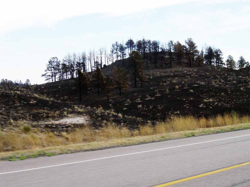 I ate lunch at a Mexican restaurant in Chadron before leaving town. The stuffed sopapilla was very good, but it wasn't an hour later when I began looking for a rest stop. Finally, just north of Alliance, I found this one, a testament to the fact that rural people tend to be very hospitable and know everyone else's business. I just wished they wouldn't honk as they drive by.
 A bit farther down the road is Carhenge, an art park of objects made of junk cars.
 Other car-art sculptures included the "carnastoga wagon"
 and "Dino," which could possibly be a T-wrecks!
 If you're familiar with Nebraska author, Mari Sandoz, whose works include "Old Jules," "The Beaver Men," "The Buffalo Hunters" and many others, you're also familiar with her father, Jules Sandoz. He and his wife Mary are buried in the Alliance Cemetery. Something I found very interesting at the cemetery, is it's computerized grave locator. Just inside the main entrance is a small structure, which houses the computer. It has a glass window to protect it from the elements, that opens as you walk up to it. You simply type in a last name and the computer searches and provides a list of graves for that name. You select the name you want and it provides the location and a map. The cemetery is well marked with with block, section and lot markers.
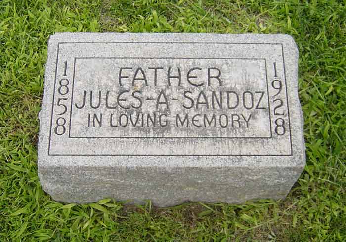 Scottsbluff and Gering form the largest metro area in the Panhandle and is home to Scotts Bluff National Monument.
 One of two covered wagons parked near the Visitor's Center, on the Oregon Trail.
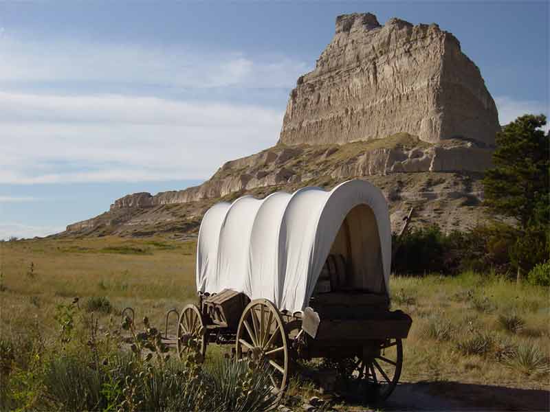 Travelling hundreds of miles in this? No wonder most of the pioneers walked along side their wagons.
After driving the Summit Road, I found a few easy trails at the top, which provided some great views of the surrounding area. Along one path, I came upon this cottontail, who seemed to be feeding on the only green stuff around. I'm at the south wall and have Chimney Rock to my back, 20 miles away.
Bronze arrows are imbedded in the walls. This one is pointing west toward "Laramie Peak 120 miles." ![]() Looking toward Laramie Peak, you can see a bend in the North Platte River (center of photo). Just left of the river is a grove of trees, then the end of a two-mile long train. Just between the tracks and the river, and this side of the trees, is the site of old Fort Mitchell.
Looking toward Laramie Peak, you can see a bend in the North Platte River (center of photo). Just left of the river is a grove of trees, then the end of a two-mile long train. Just between the tracks and the river, and this side of the trees, is the site of old Fort Mitchell.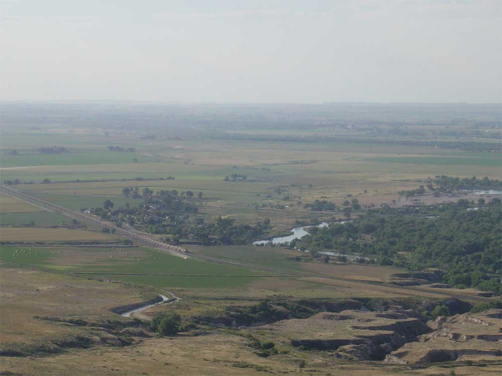
 After the Visitor's Center closes, the trails are still open until sunset. As I start the Saddle Rock Trail to the summit, this cottontail is content to just lie in the clover.
 The first half of the 1.6 mile trail is somewhat flat and winds through the prairie. Then it begins climbing, through a series of switchbacks, through a tunnel, and then more switchbacks up the other side of the bluff. The white speck in the below photo (left center) is a jogger running to the summit.
 This photo is where the jogger was photographed, with the tunnel in the center.
 Inside the tunnel, looking out over Gering.
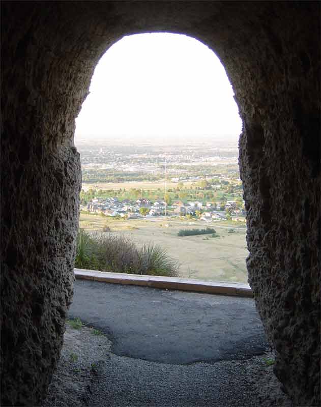 A nice shot of Saddle Rock at dusk.
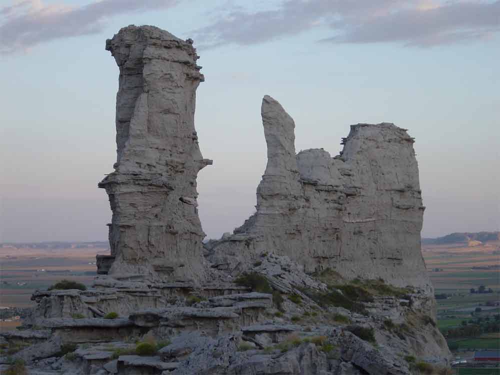 Twenty mile southeast of Scotts Bluff Monument, is Chimney Rock, a very identifiable landmark for the westward travellers on the Oregon Trail. This is a shot from the Chimney Rock Cemetery.
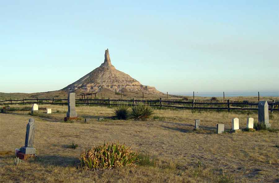 Sunflowers and Chimney Rock.
 Nebraska icons: a windmill, Chimney Rock and a Sioux teepee.
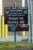
 South of Chimney Rock and Bridgeport, are some hidden landmarks of a more modern time... Cold War era Minuteman III ICBM facilities. This one is near Gurley, NE. "Hotel" was my first home away from home in 1985.
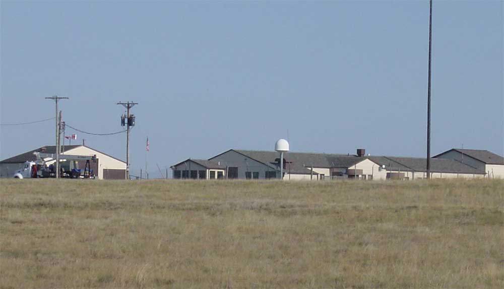
 Launch Facility Hotel-06 is a few miles away.
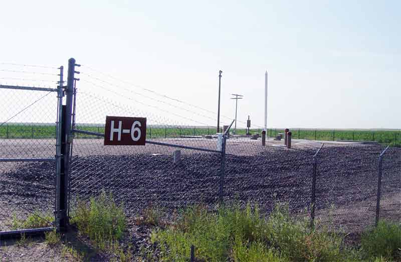 Another common sight in the West: ranchers often put their old boots "out to pasture" on fence posts, with the heels pointing toward Heaven.
 I soon was on the interstate and heading back to Omaha. I-80 is as boring as this next photo.
No comments:
Post a Comment